Showing posts with label Hillview. Show all posts

Thursday, August 18, 2022

World War Two battles around Hillview.

When World War Two descended onto Singapore in early 1942, the area that was to become Hillview in the future was still 'undeveloped' in the sense that we understand development today.

Located in the valley between the ridges of Bukit Gombak and Bukit Batok, the hill slopes were then covered mainly by rubber plantations on the Gombak slopes, while on the Bukit Batok ridge were remnants of old pineapple farms and some older gambier farms that had existed since the 1840s. This 'Hillview' valley stretch all the way from Bukit Batok hill north to the plains in front of what is the Ministry of Defence installation today. 

The only 'development' then in 1942 were the new factories of Ford Motors and the Hume Pipes Co., the more established Cold Storage Dairy Farm and the Nanyang Shoe factory at edge of Bukit Panjang Village. All these developments were along Upper Bukit Timah Road between the 8th & 10th milestones. Apart from these, it was mostly rubber plantations along the road.

It was an area that was still very ulu or rural, and at the periphery of the even more rural regions of Chua Chu Kang, Lim Chu Kang and Woodlands!

The invasion by the Japanese army towards Bukit Timah Village. 8-11 Feb 1942.
(click on the map for a detailed view)

The Japanese Invasion

On 8th February 1942, the Imperial Japanese Army invaded Singapore by crossing the Straits of Johore at the Sarimbun and Lim Chu Kang coast. 
Within the next 24 hours, the invading army had already conquered the entire Lim Chu Kang countryside and by afternoon the next day, 9th Feb, the British RAF Tengah airfield fell into their hands.

General Yamashita, the Japanese Army commander, who was nicknamed the Tiger of Malaya, had initially planned that the total conquest of Singapore would be completed by the 11th of Feb 1942.
However, his supply line was stretched too thin in Malaya and his army was running low on supplies, including food, fuel and ammunition by the time they had arrived at the Straits of Johore bordering Singapore.

Thus, he changed his immediate objective to the capture of Bukit Timah by the 11th of Feb instead.
Bukit Timah was where the British had their supplies, food stores and fuel depots and he coveted these supplies for his own men and army. 
Bukit Timah was also the highest point in Singapore which would afford the invaders a good view of the entire battlefield.
More importantly Bukit Timah was the major intersection where the main roads spread north, south and west of the island. Whoever controls the junction, controlled all movement to these areas.

With his objective set, his plan was to use two of his best army divisions, the 5th Division and and the 18th Division to capture Bukit Timah in a pincer movement. 
5th Division would moved along Choa Chu Kang and turn south at Bukit Panjang and head towards Bukit Timah with the support of Japanese tanks.
The 18th Division would move south-east through Bulim and along Jurong Road towards Bukit Timah Village, where they would converge with the 5th Division.
Both Divisions were given only 48 hours to accomplish this task of capturing Bukit Timah Village.

(There was a third Japanese Army Division called the Konoye Imperial Guards, but this unit was given a secondary task of moving across the Mandai and Thomson areas and played a more diversionary role to the main attack.)

Bukit Panjang
By the evening of the 10th Feb, the 5th Division had arrived at Bukit Panjang and was slowly maneuvering down towards Bukit Timah Village. They had fought and won fierce battles against the British at both Bulim Village and Keat Hong Village. By the time they arrived at Bukit Panjang, they also had the support of tanks which had been quickly pressed into service upon crossing the Straits of Johore.

At Bukit Panjang, the 5th Division was split into the three fighting regiments, the 11th, the 42nd and the 21st Infantry Regiments.
The 11th Regiment mauraded through Bukit Panjang Village and followed the water pipeline towards Bukit Timah via Dairy Farm, while the 42nd Regiment accompanied and provided infantry support for the tanks going down Upper Bukit Timah Road.
The 21st Regiment took the path along the Malayan Railway line and moved into the Hillview valley. This last group was given the task of capturing both the Ford and Hume factories.

Jurong
Over at the Jurong area, the 18th Division moved through the Bulim rubber plantations relatively easily till they came to Bukit Batok where they were met by the British Indian Army's 15th Infantry Brigade.
With their superior numbers and battle-hardened tactics, the Japanese forces routed the British army brigade at Bukit Batok.

Capture of Bukit Timah
By the late morning of the 11th Feb, both Japanese 5th and 18th Division had overwhelmed the British defenders at Bukit Timah Village and secure the high point of Bukit Timah hill.

Surrender
Following this victory, General Yamashita gave an ultimatum to the British to surrender.  However, the war in Singapore continued until for a few more days until the British finally surrendered on the 15th Feb, the first day of the Chinese New Year in 1942.
Three and half years of brutish Japanese Occupation was to follow for the citizens of Singapore.

For those who find this article TL;DR, I have actually done two videos on the same subject.
You can watch the video on Youtube at these links:-


Part 1. The Battle of Choa Chu Kang


Part 2. The Battle of Bukit Panjang

Further related links:-
Post-war history of Hillview

Sunday, May 9, 2021

The sarabat stalls at Hillview Road

A sarabat stall is basically a makeshift coffee stand, in days gone by.
Unlike an itinerant or travelling hawker, the sarabat stall was usually rooted temporarily at the same spot for a period. It would sell freshly brewed coffee, tea, cold drinks and snacks for a quick bite.

Often ramshackle and unkempt, they were found usually at places like construction sites or near places where people gathered like markets, factories and bus terminals. It was mainly good for a quick cuppa or a smoke during office break or while waiting for the bus.
 
The name sarabat derived from the Malay sarbat or ginger juice that was mixed with the milk tea, the main beverage sold at these stalls. This concoction is still available today as Teh Halia.


The sarabat stall opposite the Eveready battery factory gates along Hillview Road.
Behind the fence is the Hong Kong Rope Manufacturing Co. 


There were two sarabat stalls that operated along Hillview Road in the 1950s and 1960s.
These were located aside the main road directly opposite the main gate of the National Carbon factory. This factory was also known as Union Carbide or the Eveready battery factory.  The factory began production way back in 1948 but it is not clear as to when the sarabat stalls starting operating at this location.

The above photo shows one of the two sarabat stalls in existence then and was taken pre-1963. 
The aerial photo below of Hillview Road was shot in 1958 and already shows the two sarabat stall along the fence of the Hong Kong Rope factory (yellow circle).

Beside the two semi-permanent sarabat stalls, I was told that there was also an occasional push cart hawker selling cut fruits and cold plum and starfruit juice at times. These hawkers catered mainly to the factory workers during their lunch and tea breaks, especially to the staff of both the Eveready factory and the adjacent Hong Kong Rope Manufacturing factory. Customers included the occasional kampong folks and residents of Princess Elizabeth Estate as well, who had to pass the stalls as they walked along Hillview Road to reach the main road at Upper Bukit Timah.


(Photo source: NAS)

The sarabat stalls were located at the top of the ridge, across which Hillview Road ran from Upper Bukit Timah Road to Hillview Avenue. It was at this very point that the Green Bus Co #5 bus had Request Bus-stops* on both sides of the road, obviously to serve the factory workers as it was just by the company's main gate. 

In the above picture of Hillview Road, you might be able to make out the sloping road that peaked at the area where the stalls were. Today, the slope is not as steep as it once was. The gradient having been reduced with the building of the condominiums around the mid 90s, as well as with the regular accretion from road re-surfacing and maintenance over the decades.

(Photo source: NAS)

Green Bus Co Service #5 driving up the slope from Hillview Circus.
It would crest the Hillview ridge just where the sarabat stalls stood at the top of the ridge.
Note that even in 1955, there were no concrete footpaths along the sides of Hillview Road.


(Photo source: NAS)


Green Bus #5 coming up the slope from Upper Bukit Timah Road side.
The KTM Railway girder bridge was built when Hillview Road was constructed in 1947.


(Photo source: ijamestann.blogspot.sg)

Photo taken in 2011 after the removal of the KTM railway line over Hillview Road.
You can see that the slope is much gentler than in the old days.


*Request Bus-Stops
For those who are unaware, especially of the younger generation today, bus stops in the old days of the mosquito buses were known as 'Request Stop'.  A bus will stop at a 'bus-stop' only when a passenger wanted to alight by pressing the bell, or if there were passengers waiting to board at the marker, which was usually only a metal pole with a number plate. The bus would continue on if the bell was not rung, unlike today where it is usual for all buses to stop at every bus-stop in order to keep to their planned scheduled times.
A "Request Stop"  outside St. Andrew's Cathedral


In those days, there had been many incidents and arguments where the bus would not stop while a passenger will claim that they had rung the bell. Nasty bus drivers, which were common, might hesitantly and purposely stop a long way from the Request Stop and some would even continue on and let the passenger off only at the next stop! Most bus-stops did not have shelters except for those in popular areas. The Request-stops at Hillview Road were not sheltered in those days.


(Photo source: NAS)
The sarabat stall opposite the gate of the Eveready battery factory.
At the far right distant, you can see the KTM railway bridge running over Hillview Road.

My own personal recollection of the sarabat stalls is very vague. It would be in the early 1960s when my father was still working at the Eveready company. I can only recall that my dad used to stop his car at the sarabat stall and would alight to buy cigarettes from the Indian Mama (uncle). We would be driving out from Princess Elizabeth Estate and he would only patronise this stall as he was familiar with them. It was a habit he had, or perhaps he had credit with the Mama? Apart from that scant memory, I cannot recall if I ever had a drink at this stall at all. I was too young then.

Illegal itinerant hawkers as well as makeshift sarabat stalls were all moved off the streets from 1965 to 1971 as part of the government's plan to resettle all hawkers to more hygienic and proper facilities.
So, for those of you who lived at Hillview after the mid 60s, it would be very unlikely that you would have known of these sarabat stalls. There were also sarabat stalls at the #5 bus terminus at Princess Elizabeth Estate too.


In a future article...
If you look again at the aerial overhead photo, you can see a yellow square at the junction of Upper Bukit Timah Road and Hillview Road. This was directly across Hillview Road from the old Chartered Bank. 
It marks the homes of two Indian families who used their house front as shops to sell Indian food. Many will recall these two Indian shop houses as they were also beside the main bus stop heading into the estate.

I will blog about this eating house in a future article, as well as about the HDB Food Centre (photo below) that was built in 1994 at the new HDB Hillview Estate.


(Photo source: Internet)


Quick links to related articles about Hillview Road
The building of Hillview Road
The removal of the Railway Bridge
The development of Hillview Avenue
The Eveready Battery factory

Wednesday, December 9, 2020

Malayan Guttas Vintage Photographs

Malayan Guttas Ltd  was a pioneer factory at Hillview, Bukit Timah. 
Many of you may never have heard of this company,  unless perhaps, you once lived nearby around Hillview or you might have known of it perusing through this blog of mine where I had previously written a few articles about it. (links below)

However, you will definitely recall its most famous product - the Wrigley Spearmint Chewing Gum.
The Wrigley Company of Chicago USA set up the factory in 1947 soon after the end of World War Two.

Following the end of war, the British Government offered extremely good incentives for foreign companies to invest in the colonies to revive the war-torn countries' economies. One major incentive was that their manufactured goods would be entirely tax-free if it was manufactured, distributed and sold in any British Commonwealth nation.

As a result, Malayan Guttas became the biggest manufacturer and distributor of chewing gum in all the British Commonwealth out from its factory in Singapore.
The other major incentive for Malayan Guttas was that its principal ingredient for making chewing gum could only be found in the Malay Peninsula, i.e. the then Malaya, Borneo and Indonesia. This was the resin Gutta Percha.


Gutta Percha resin is the inedible bit that gum chewers spat out and made a mess of the sidewalks!
Gutta Percha came from the endemic Sapodilla tree, of which the Chiku fruit tree was one species.
However, extracting the gutta percha resin was primitive even in those days. It had an unsustainable and destructive process in its extraction. They had to chop the entire tree down to bits and boil the wood to extract the resin. 
By the 1960s, due to the scarcity of the Sapodilla trees, they switched to the resin of the Jelutong tree. So Malayan Guttas became the biggest source of Jelutong resin and the centre for worldwide distribution.

Ironically, chewing gum was banned in Singapore in 1992 but by a strange twist of fate, the entire region of Hillview where the factory sat was then re-designated into a 'residential development zone'. The Wrigley Company sold the land to a private developer for a fortune in the late 1990s. The land was developed into the now Hillington Condominium complex.


The newly built Malayan Guttas factory in 1948.


Recently, I was very fortunate to receive a package of old photos from Switzerland.
It came from Pierre-Yves Bünzli, son of Mr Bünzli who was the General Manager in the late 50s to the early 60s.
In those days, the GM was numero uno. He oversaw the entire operations and personally lead many expeditions to Borneo to source for Jelutong resin.

The cache of vintage pictures, of which I will release periodically in future articles, were of the factory operations and of the staff.  Many of the staff were from the old Princess Elizabeth Estate and if you do recognise anyone of them in the photos, please comment below.


The cache of vintage photos I received.


The machinery used in the resin extraction


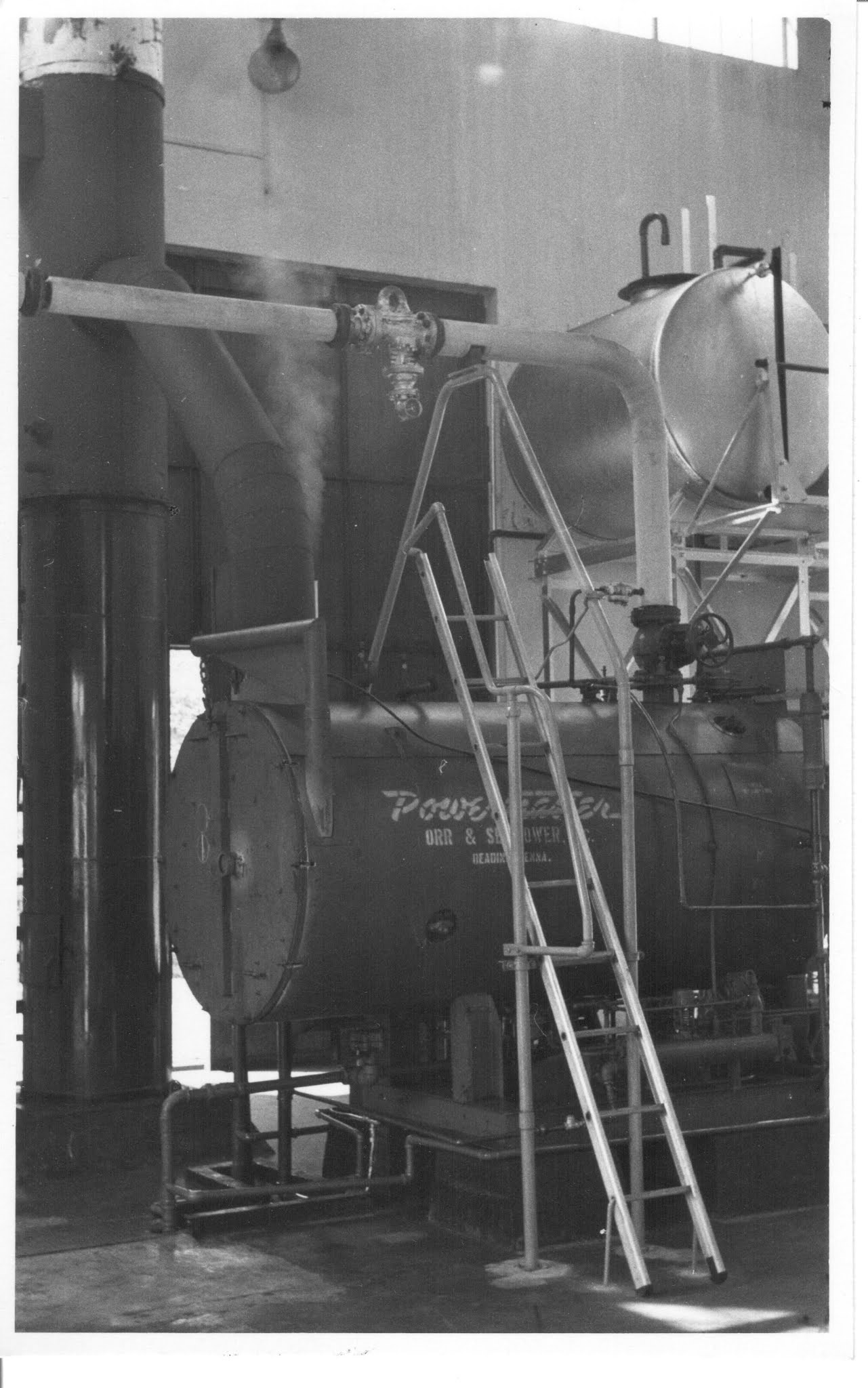
The boilers used for resin extraction


Crates of resin extract stored at the back


Staff Group Photo c.1962


Staff function at the factory grounds.


Thursday, August 20, 2020

The Railway lines at Hillview

In my previous article that I posted in July regarding the Hillview factories along Upper Bukit Timah Road, a lot of interest was centred on the two railway lines that ran past Hillview. These were, firstly, the 1903 Singapore-Kranji Railway, and secondly, the 1932 KTM Railway that 'replaced' the 1903 railway line. I must clarify that even though I occasionally write about the railways, I am not a rail enthusiast, nor an expert on this subject, and my writings about them only relate to my blog articles here.

One of my contacts, a local railway expert, Trevor Sharot, had earlier re-discovered and confirmed the existence of a tunnel that was seen in old 1950 aerial photo maps. This tunnel is under the now 'Green Corridor' and is not clearly visible by any and all who trek along this conservation corridor. It is covered by shrubs and overgrowth. I have marked it out in this 1950 aerial photo. I will do a writeup on this tunnel in a future blog article.


The hidden tunnel under the old 1932 railway track.


Another old friend and railway enthusiast, Peter Chan, also got in touch with regards to the older 1903 Singapore-Kranji Railway. Peter's grandparents lived at the Chestnut area and had seen the building of the 1932 KTM railway that was to replace the 1903 Singapore-Kranji Railway.
More fortuitously, Peter's grandfather had the presence of mind to take photos of the construction in those days, and Peter shared one with me.


What is interesting about the black & white 1931 photo is that it shows the steel truss bridge being built across Upper Bukit Timah Road in 1931 for the new KTM Railway that would run to Tanjong Pagar. This now retired truss bridge is being conserved today as a heritage item along with the rail corridor.

What is of greater interest in this B&W photo (especially to rail enthusiasts) is that you can see behind the bridge, the level on the hillside where the older 1903 Singapore-Kranji Railway line ran down from the hill (where Ford Motors would later be built). It was on a higher level above Bukit Timah Road.

With Peter's permission, I enhanced the old B&W photo and found that I could then make out the old telegraph poles that ran alongside the 1903 Kranji railway tracks! The old telegraph poles were significant in determining the layout and alignment of the 1903 tracks as seen in my previous posted article. (The red line).
In the old days, telegraph poles were built parallel alongside the railway lines.

 Note the 1903 telegraph wires up on the bridge level (right of pic).
There also appears to be overhead electrical cables alongside Bukit Timah Road as well. These can be seen beneath and beyond the bridge.


Peter then sent me more photos he had!
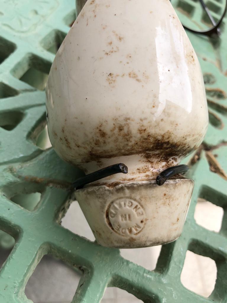
These were the actual remnants of the telegraph poles which he found and had kept!


Parts of the 1903 telegraph poles.

Insulator
The telegraph wire insulator.
(Peter's souvenir from 1903)


Monday, July 20, 2020

Hillview as seen from Upper Bukit Timah 1957.

Source: National Archives of Singapore/British Royal Air Force Collection.
Thanks to Lai Chee Kien and Trevor Sharot for confirmation of the 1903 line location


Here is a picture that is worth a thousand words!
Colorised from an old RAF Sqn 81 aerial survey photo taken in 1957, this is the Hillview region at 9th milestone (14km), Upper Bukit Timah Road.

On the left are the factories of Hillview in 1957, starting with Hume Pipes Co Pty Ltd at bottom, Rheem Hume Co Ltd, Malayan Guttas Ltd, National Carbon and finally, the Hong Kong Rope Manufacturing Co. The Chartered Bank Hillview Branch is to the right of Hong Kong Rope Mfg Co.

Fuyong Estate is across Upper Bukit Timah Road and the KTM Railway truss bridge straddles the highway prominently at this point.

The red roofed buildings today house the Rail Mall shopping arcade and eateries. It was built in the early 1950s by philanthropist, Mr Lee Kong Chian, as low-cost workers quarters to house his employees who worked his rubber plantations in the area. I used to live at Fuyong Estate from the mid-60s till the mid-1980s. My old house was the 4th semi-detached unit up the hill behind 'Rail Mall' . The back of my old house faced the factories across the road and everyday I would see the KTM trains going by.
You can't miss the trains because at this point, just before the girder bridge at Hillview Road, they were required to 'WISEL', as the signal signboard indicated. Whistle to warn of an approaching train.

Among other things to note here was the railway sidings just to the left of the bridge. There were two sidings, off the main railway line, that were used exclusively by the Hume Pipes Co. These were used to load the manufactured pipes for conveyance up to Malaya then, where Hume Industries was a major supplier of concrete pipes for the country's development. 

The first railway line that ran through Hillview was the 1903 Singapore-Woodlands Railway (aka the Tank Road-Kranji Railway). I have sketched out the approximate line location where the 1903 railway ran through this part. (red line).  The other railway line that passed Hillview was the 1932 KTM railway line. The 1903 railway line became defunct, and eventually removed, when the 1932 KTM railway line started operations.

Initially built by the Federated Malay States Railways (FMSR). It was later incorporated by the governmental Malayan Railway Administration (MRA) and in 1962 became known as the Keratapi Tanah Melayu (KTM), the name which most of us associate the railway line with. 

It was the FMSR that built the black truss bridge over Upper Bukit Timah Road, which has now been declared a heritage conservation structure.
The former KTM railway line was closed and subsequently removed in 2011 and the old rail bed is now preserved as part of the Green Rail Corridor conservation project.

Related reading.
The Hillview Road Girder Bridge
Rail Mall

Sunday, July 19, 2020

Factories around P.E.Estate #13 - Malayan Textile Mill

       After all these years describing the various former companies and factories located at Hillview, you would think that Malayan Textile Mill would be on top of the list. It being one of the original four factories set up back in 1953. Yet until now, it was left out because I really did not have much information on this entity! It'll also probably be the last factory to be covered in this series on the factories around Princess Elizabeth Estate.


Fronting Hillview Avenue with its distinctive serrated roof, the Malayan Textile Mill was built on a large 3000ha piece of freehold land. In the 1950s, textile production in East Asia was becoming very popular due to the low cost and producers in Hong Kong, Taiwan and Japan were getting renown for their quality textiles.

Malayan Textile Mill was set up to spin yarn.  Yarn being the raw material used by other textile mills to produce finished fabrics, textiles, knittings and other types of cloth.

The Malayan Textile Mill machinery spinning yarn on spools.
In the tumultuous 1960s, the factory was involved frequently with workers wildcat industrial action and strikes. This was a time of growing awareness of workers rights, mainly over the low wages and working conditions.

By the 1970s, there were up to 25 textile mills in Singapore but most were inefficient and unprofitable. It was an industry where local expertise and skilled workers were in very short supply. Experienced textile workers tended to migrate to other factories with better pay. This eventually led to a detrimental situation for the entire textile industry in Singapore, and to the eventual closure of most mills.

The Malayan Textile Mill was bought over by another company and renamed as the International Spinning Mill. It lasted well into the early 2000s when it was sold to real estate developers to built condominiums on the site.

Today, Hillview Green Condominium sits on the old factory site along Hillview Avenue.


Related links:-
#1 Factories that were located at Hillview
#2 Cycle & Carriage
#3 Ford Motor
#4 Amoy Canning
#5 Malayan Guttas
#6 Castrol
#7 Union Carbide
#8 Kiwi Polish
#9 Magnolia Dairies
#10 Hume Industries
#11 Hong Kong Rope Manufacturing Co
#12 Central Oil Refinery
#The Hillview Industrial Estate

Monday, July 13, 2020

1924 map of Hillview area.

Recently, I was chatting with a friend about the old Singapore-Woodlands Railway, aka the Tank Road-Kranji Railway of 1903. This railway ran past Hillview along Upper Bukit Timah Road. I mentioned I had an old map which showed the railway alignment and went to search my archive. I have not used this map previously in my blog because I couldn't link much to what I could say about Princess Elizabeth Estate, it being drawn 30 years before Hillview and PEE even existed.

Here is an extract of the 1924 map. I have superimposed the main roads of today's Hillview into the map for you to reference in reading the map.

Click on the picture for a detailed view.

On seeing this old map and scrutinising it closely this time, I came to a realisation that I was mistaken all this while about the old 1903 rail alignment. I had always assumed that the line ran alongside Upper Bukit Timah Road from Mendoza Village, up to where the Ford factory would be, and then followed the road downhill and northwards towards Bukit Panjang. 

From the map, I saw that from where Ford would be, it continued up on a high embankment (in fact following what is today Hume Ave!) before coming down towards the Chartered bank /MRT Station level and then continuing on northwards.
It did not run alongside Upper Bukit Timah Road from where Ford would be to the Chartered Bank! You live and you learn new things everyday. I stand corrected.

This is the junction of Hume Ave and Upp Bt Timah Road, just after where the old Ford factory was.

The 1903 Singapore Kranji Railway travelled up on the road on the left (now Hume Ave). Upp Bt Timah Road (right) went downhill from here towards Bukit Panjang. I had mistakenly assumed the old 1903 Railway followed the downhill road.
The 1932 KTM Railway was on a different alignment parallel to Upp Bt Timah Road here, beyond the trees to the right. The 1932 KTM Railway would cross Upp Bt Timah Road at the black Truss bridge near today's Rail Mall. (Jalan Asas)Pic from Google Earth,

In line with the recent articles I wrote about the history of Hillview, and looking closely at the map, you can see that the entire area was marked with 'rubber trees' or rubber plantations (green map symbols). So this confirmed that the entire Hillview area was a rubber growing region in 1924.

Also marked in the area around the peak of Bukit Gombak (top left) you can see markings of 'pineapple' symbols.  This would also confirm that the Hillview region went through the agricultural stages from gambier to pineapple and lastly to rubber.

Lastly, this map also vindicates what I always debunked as a myth when people ascribe the name Bukit Batok to the 'coughing' of the dynamite blasting of the granite quarry giving rise to the name of the hill as Bukit Batok - "Coughing Hill".  (Map lower centre)
The quarry at Bukit Batok, called the Poh Kim Quarry, operated only after World War 2 ended in 1945. Yet this 1924 map already had the name Bukit Batok pinned to it. So the coughing hill theory is totally debunked.

Something, you might also want to note is that in this 1924 map, Upper Bukit Timah Road and Woodlands Road were actually named as Kranji Road.

This is a superimposed Google map over the 1924 which I used to get the road alignments.


Note: The 1903 Tank Road-Kranji Railway is a different rail line to that of the 1932 KTM (Keretaapi Tanah Melayu) Railways that ran almost in the same alignment from the black railway bridge at Rail Mall to Woodlands. 

Monday, December 23, 2019

Factories around Hillview (#11) - The Hong Kong Rope Mfg Co. Ltd.

The HK Rope Manufacturing Co at Hillview.
In the background is the Chartered Bank building along Upper Bukit Timah Road
and the Salvation Army Children's Home across the road.

The Hong Kong Rope Manufacturing Co Ltd was one of the early set-ups in the newly established Colonial Industrial Estate at Hillview. They started operations in 1953 and was one of the four pioneer factories to be located along Hillview Avenue.

This Hong Kong establishment was enticed to invest in a manufacturing facility in Singapore through generous grants and incentives given by the then Colonial Development Corporation. They would be the main supplier of manila ropes for the shipping industry as Singapore gained momentum as a modern entrepot port. It was located on an eight acre plot at the junction of Hillview Road with Hillview Avenue.

Even while it was the only local manila rope manufacturer, the company had to struggle with declining sales for manila ropes over the years of operation. This was due to their inability to re-configure their factory to produce what the market was then turning to. That product was the new, cheaper, stronger and more durable nylon ropes!


The Straits Times report of 17 March 1954 announcing the opening of the factory.


The HK Rope Manufacturing Co shuttered its factory in 1963 and sold the property to the British Castrol Lubricant Company.


The Castrol Lubricant factory that replaced the HK Rope Mfg Co.

Today the same site is occupied by the Glendale Park Condominium complex.


Related links:-
Factories that were located at Hillview #1.
#2 Cycle & Carriage
#3 Ford Motor
#4 Amoy Canning
#5 Malayan Guttas
#6 Castrol
#7 Union Carbide
#8 Kiwi Polish
#9 Magnolia Dairies
#10 Hume Industries
The Hillview Industrial Estate


Saturday, November 30, 2019

The railway bridge at Hillview Road.

Before the year 1948, what would become Hillview Road was nothing more than a country track that was the land boundary between two gambier plantations belonging to Messrs. J Jacobs and Messrs. Tang Kok. This boundary track led from Upper Bukit Timah Road at 9-1/2 milestone into the Bukit Gombak farms and rubber plantations.

What had puzzled me for a very long time was the railway girder bridge that was built over the later Hillview Road.  I was confused because I knew that Hillview Road was only constructed in 1948 but the KTM (Keretaapi Tanah Melayu) railway line was built in 1932, a good sixteen years before the road was built. So my question was 'Did they build the girder bridge over a country track?'. If so, why would they do that? Was there a need to build a bridge there? It didn't make sense to me.
Moreover, about 500m further down, there was also another country track called Lorong Taluki. This track crossed the KTM line too but there was no bridge, just a slope up to the embankment and then down the leeward side. Why did they need a bridge here?


I even referred to my good friend, Dr Lai Chee Kien, who has extensive expertise with the rail system in Singapore. Dr Lai and I both lived at Fuyong Estate before where we would see the KTM trains passing everyday on the high embankment along the Hillview ridge. Dr Lai wasn't too sure of the reason as well. So, was the bridge there even before Hillview Road was built?

For a long time, I left the question open till about a month ago when I found a photomap dated 15 April 1948. The aerial map showed the on-going construction of Hillview Road and Hillview Avenue on that date. It totally resolved the question of the girder bridge!

(Click on photo for a detailed view)

The girder bridge was built at the same time as the construction of Hillview Road in 1948!
There was no girder bridge when the railway line was built in 1932. In order to construct Hillview Road, KTM had to create a temporary diversionary rail siding to allow for the construction of the girder bridge.*
(Correction: From further research into the area, the previous original sentence is incorrect!.
While building the road, they DID NOT build a diversionary rail to bypass the road and bridge construction.
It seems that the curve of the railway line at this section towards Bukit Timah Road was the original path of the railway line. The girder bridge over the road was a new section of the railway line that was built and replace that curved section.)

Hillview Road was created by cutting through the ridge from Bukit Timah Road. Passing the road today, you can still see the cut made then. Hillview Road is like a huge hump with the summit exactly where the gate of the former Union Carbide Co (then National Carbon) was. Hillview Road and Hillview Avenue were specifically created for access to the two new factories of National Carbon and Malayan Guttas.

As I had mentioned in a previous article, the creation of Hillview Road and Hillview Avenue was the first time that the area was officially called 'Hillview'. The name was used because at the other end of this Hillview ridge near Bukit Batok Hill, there was a grand private country estate called 'Hillview Estate'. This country house Hillview Estate was the wartime headquarters of the Australian Division that fought the invading Japanese army in 1942.

Though, adequate at its time, the girder bridge at Hillview Road was to become a bottleneck for vehicles with increasing economic activities in the 1970s. Hillview Road was then the only access to the industrial factories being built at Hillview. The solution, in 1969, was to extend the other end of Hillview Avenue to join Jurong Road at Bukit Batok.

The girder bridge was dismantled and removed on 26 November 2011 as a result of the return of the KTM land by the Malaysian government to Singapore. The bridge support buttresses were only removed in 2017 and we can expect that Hillview Road will be further widened in future to accommodate the increasing traffic through the area.

The KTM railway girder bridge at Hillview Road.


The bridge was dismantled in November 2011.


Other links to the girder bridge:-
The Girder Bridge at Hillview
The development of Hillview Avenue
The colonial Hillview Estate


Thursday, October 24, 2019

Of Udaya and the Mendoza Cafe.

Quite recently, with all the talk about the Green and Rail Corridor proposals by NParks Singapore to preserve what's left of the natural space vacated by the KTM Railway,  the Urban Renewal Authority (URA) published a pictorial map of a proposed plan.  This was the upcoming linkage between Bukit Batok Hill to the Rail Corridor, near the old Bukit Timah Fire Station.

This is the URA plan for the Green Corridor linking Bukit Batok Hill with the Rail Corridor with an aerial walkway
and an Eco-bridge across Upper Bukit Timah Road. Picture source: URA Singapore
Superimposed labels are mine for illustration for this article. (click to enlarge)

When I saw this, I said "Ah, this is something for my blog. Something people will not know about unless they are in their 60s or older now and lived around Upper Bukit Timah!"

This 'something' is the large plot of land between Lorong Sesuai (the road leading to Bt Batok summit) and Upper Bukit Timah Road (up to the former Ford Factory).

This was the location of one of the last kampongs in Singapore. It was colloquially known as the Mendoza Village with its single road, Jalan Udaya. By the 1970s, the village had more than a hundred kampong houses within the precinct, but was completely obliterated in 1985 under Singapore's plan for the removal of all squatters and kampongs. However, the kampong was not technically 'squatters' until after the land was re-acquired by the government.

The site was until then owned by the family of a certain Mr. Joseph Png Swee Thong.
Joseph Png was a wealthy landowner who own large swathes of land in Bukit Timah and Bukit Panjang from the 1920s onwards. He also owned the stretch beside the KTM Railway line from the Bukit Timah Fire Station up to Kampong Merpati opposite the Ford Factory.

Part of the Mendoza village adjacent to the Ford factory.


This is a map produced in 1972 showing the area of Mendoza Village with its only paved public stretch of Jalan Udaya for access. Within the village, the roads were unnamed tracks. It was located immediately south of the Ford Motor factory on the eastern slope of Bukit Batok hill.

(Extract from Singapore Map 1972, National Archives)
The area shaded in blue was owned by Png Swee Thong & family.
Note the large number of kampong houses mapped.

Why was it strangely called Mendoza Village? And what was the meaning of Udaya, the name of the only road way into the village.

Mendoza Village, or Kampong Mendoza, was named after Clement Mendoza. Clement Mendoza was an Indian Eurasian descendent of the Mendozas from Mangalore, India. In 1925, Clement Mendoza married Miss Agusta Png, the daughter of Png Swee Thong, who was the landowner. Ahh, you say!
Mendoza lived at a shophouse fronting Upper Bukit Timah Road. It was an eating-shophouse selling food and drinks. They collected rent from tenants who built their kampong houses there and was in fact the de facto landlord for the village. The village, with its Eurasian name, had mostly Chinese tenants but there were many Malay and Indian families who built their homes there as well. Within the kampong, there were also a few provision shops. One was ran by an Indian and another by a Chinese who named his store Kedai Beng.

A typical Chinese kampong house that would be found at Mendoza village.
(Picture source: National Archives Lee Kip Lin collection)


During World War II, British prisoners-of-war (POW) were forced to work at the Ford Factory. One group of POWs were from the 1st Leicestershire Battalion. They were made to build fences at the Ford Factory. Private Tom Sansome, a former POW, recalled that after toiling at the Ford Factory, they had to marched down from the factory to MacArthur POW camp at Reformatory Road. However, they were allowed to stop at the 'Mendoza Cafe' for refreshments before the start of their return march. "It was a small shack adjacent to the factory fence that we had built", recalls Pte Tom Sansome.

In an episode during the Japanese Occupation, the Mendoza family was caught harbouring an escaped prisoner from the work gang.  The Mendoza family was forcibly evicted from the house and the house was occupied by Japanese officers from then.

In 1958, the Malayalee community around the area started a library to promote reading amongst the Malayalee workers who worked at the nearby factories of Hume, Ford, Gammon, Union Carbide and the nearby granite quarries. They registered an association called the Kairali Library and used a kampong house in the village for this purpose.

In 1959, on his victory lap around Singapore, the Prime Minister Mr Lee Kuan Yew, stopped at the village to thank voters for his party's victory at the 1959 General Election. Mendoza Village was a staunch Party stronghold then. He paid a visit to the Kairali Library and when he was told that the 'road' outside the library was unnamed, Mr Lee declared that it would henceforth be called Jalan Udaya. By 1965, it was officially in the government street directory.
Udaya, a word with religious connotations, in Sanskrit or Marathi means 'growth' or 'increase'.

When Mr Chor Yeok Eng became the MP for Bukit Timah in 1966, he based his Citizens Consultative Committee (CCC) at a kampong house in this village across the road.

The entire estate owned by the Png family, said to be approximately 75 hectares in area, was acquired by the government in the 1980s. It was rumoured that the compensation to the landlord was $2m at that time. The kampong folks were offered flats at the upcoming HDB Hillview Estate at Hillview Avenue. The Kairali Library with its collection of Malayalam books was offered space to display its books at the new Bukit Gombak Community Centre at Hillview Estate. It was later given a room at the Education Centre set up at Blk 11 Hillview Estate.
The kampong was completely demolished by 1985 and Upper Bukit Timah Road at that area was widened to improve traffic flow.

In the late 1960s, I had to travel to school by bus passing the Mendoza Village to and fro, and I can still recall the Mendoza eating-shop facing the roadside. This was because my regular Indian barber had shifted his shop from Fuyong Estate, where I was living then,  to set up his new shop beside the 'Mendoza Cafe'. I believe they had partitioned the food-shop to rent the space to the barber.

Here is a very interesting overhead aerial photo of the area (you must have concluded from my blog by now that I'm an aerial photo fanatic!). This was from 1950 when the RAF did aerial surveys of Singapore Island.
In the photo you can see the Mendoza village beside the Ford factory building. You can also see the summit of Bukit Batok with the foundation base of the Japanese Chureito Syonan memorial still in existence then and the little Allied War Memorial behind it.
(Click on the picture for an enlarged detailed view)


In this picture, you can also see the relic of the original Tank Road-Kranji Railway line that ran right through Mendoza Village. Dismantled in 1932, the mound on which the railway sleepers were laid can still be seen today if you search and look closely.
I was there about two months ago doing bird photography and could still see some remnants of the mound. (oops, did I just give away my secret birding spot?)

Heritage hunters may want to check it out as this is about the ONLY place where you can still see the original 1903 Tank Road-Kranji Railway line left today.
You can also see the colonial 'Hillview Estate', the namesake for the future Hillview region, at the bottom of the photo.  To learn more of this country estate, click on the related link below.


Postscript: addendum to this article 26 October 2019.
After publishing the above blog article, I was contacted by members of the Mendoza family (Anne and Thomas) with whom I had no previous contact, expressing their thanks for highlighting their family history with regards to the Mendoza kampong. They also gave me permission to publish their private family photos here.
Anne also confirmed that the Mendozas were the landlord, and that she remembered that as a little 9-year old child, she accompanied her aunt, Ah Yee, around the kampong to collect rent from the tenants.


Joseph Clement Mendoza (with dog).
The namesake of Mendoza kampong at Jalan Udaya.
He married Agusta Png, daughter of the landowner Joseph Png Swee Thong.

The grave of Joseph Png Swee Thong, who owned Kampong Mendoza.
He lived to a full 101 years old and died in 1951.
He was buried at St. Joseph Church cemetery at Chestnut Drive.

A newspaper cutting from the Singapore Free Press of 4th Dec 1958
announcing the 'electrification for 'Kampong Mendosa Bukit Timah Road'
Postscript 2: 
I also received from a friend from the UK, WW2 researcher Ken Hewitt, a picture of the ex-POW, Tom Sansome whom I mentioned above. Tom Sansome just celebrated his 100th birthday last month.


Ex-POW, Tom Sansome (in wheelchair), who was forced to work at the Ford Factory during WWII.
Tom just celebrated his 100th birthday in Sept 2019 with congratulations from Queen Elizabeth
Photo: courtesy of Ken Hewitt


Related links:-
The Ford Motor factory
Bukit Batok Hill
The Japanese Memorial Syonan Chureito
The Colonial Hillview Estate

Saturday, October 19, 2019

An anecdotal history of Hillview Part 3. 1951-2019

The industrialisation and gentrification of Hillview


Hillview Circus - the roundabout is the only landmark remaining from the creation of Hillview.

In 1948, the British Government created a new statutory board called the Colonial Development Corporation (CDC). Its task was to promote and assist economic development of the post-war British colonies worldwide, especially in S.E.Asia and Africa. In S.E. Asia, it determined that the then Malaya and Borneo would have agriculture as its basis for their economy, while Singapore would pursue an industrialisation program.
In 1951, they proposed the construction of two industrial zones. One at the Redhill area and the other at Hillview, Bukit Timah. These would become known as the Colonial Industrial Estates.


The Colonial Industrial Estate at Bukit Timah
At Hillview, the CDC secured 53 acres of land and set about clearing the "gambia forest ", at an eyebrow-raising cost of £500,000, to prepare the land for new factories under their industrialisation programme.
Their plan was to raise twenty-two plots on which they would construct prefabricated factories. Each plot would be about 2 acres and businesses could apply to buy these pre-built factories on hire purchase, or seek favourable loans from the corporation to build their own factory. The land could be on long-term lease or bought freehold. The CDC would even provide loans to kick start their operations.


The Hillview Colonial Industrial Estate (in green) as proposed by the CDC.
Hillview Avenue was extended for a further 1/2 mile (about a kilometre)

Initially, the  CDC managed to secure six enterprises to begin operations at the fledgling estate.
These were:-
1. Malayan Textile Mills, to produce cotton yarn,
2. Central Oil Refinery, to produce cooking oil, soap and margarine from palm oil,
3. Kiwi Polish Co, to produce shoe polishes and waxes,
4. Hong Kong Rope Manufacturing Co, to produce manila ropes.
5. Siglap Development Co, to produce edible oils,
6. Davar Company, to produce ceramic tiles and building material.

The first four companies began production in 1953 & 1954. However, the Siglap Development Co and the Davar Company failed to start and rescinded their contracts with the CDC.

In 1954, the CDC changed tack. After failing to lure more overseas buyers, it decided to offer the factories to local businesses to shift their operation from overcrowded Geylang, Kallang and Lavender to the new industrial estate.  Despite generous incentives, there were no takers. It was, in a great part, due to social issues at the time, a mistrust of the British government corporation with its stringent and rigid rules, and that Hillview was so remotely located.

The project was floundering by 1958. The colonial's plan of economics by committee had fallen flat on its face.  Only one more company was convinced to set up a business there. In November 1958, the F. E. Zuellig (M) Ltd company bought 5 acres to set up an animal feed mill. Only these five companies were ever located at the Colonial Industrial Estate.

Notwithstanding the slow progress of the industrial venture, the Chartered Bank was convinced to build a branch office at Hillview. It opened in April 1957 and would serve the industries and businesses in the rural area of Upper Bukit Timah, Bukit Panjang and Woodlands. It would go down in history as Singapore's most held-up bank. It was robbed at gunpoint in 1964, 1974 and again in 1980.


The Colonial Industrial Estate at Bukit Timah in 1958.
Only the 4 original factories, plus one, were operating.

(Click for detailed view. Photo source: National Archives Singapore)

The late 1950s and early 60s were tumultuous times, with social and labour problems rampant in Singapore. Wildcat strikes at the slightest instigation were held. Workers from the Hillview factories including Ford Motors, Hume Industries, Malayan Guttas and Hong Kong Rope Co all participated in some form of industrial action during these times.


Workers on strike at the Ford Motors company.

In May 1959, Singapore obtained full internal self-government from Britain. Singapore now had to manage on their own. This included the problems of high unemployment, lack of housing and education for the people.
The new government initiated bold plans to solve these issues. Until then, Singapore depended heavily on entrepot trading. The new focus was now on industrialisation and labour-intensive industries. Foreign investments were lured with 'pioneer' status, tax holidays and generous grants and incentives. The push was for more factories and more jobs for the population and providing technical training to work in these new industries.
Key to this was the creation of Jurong Industrial Estate in 1961 to spearhead the industrialisation programme. Building new factories, creating jobs and opportunities were urgent and crucial for survival. When Singapore became an independent nation in 1965, these issues became even more critical.


Re-vitalisation of Hillview 1961 to 1994

In 1965, the Economic Development Board, tasked to lead Singapore's economic development, identified and designated Hillview as a Light Industries Zone to provide secondary support to the heavy industries in Jurong.  Hillview was given a new lease of life! It would be known as the Hillview Industrial Estate.

Land at Hillview was doled out generously for startups and a flourish of new industrial buildings came on-stream from 1965 onwards. New set-ups at Hillview included big names like Cycle and Carriage which set up a factory to assemble Mercedes Benz cars, Daihatsu and Isuzu trucks, Supreme Star Ltd built buses for SBS, Cerebos with their famous Brands Essence of chicken. Others were Lam Soon Oil and Soap Manufacturing, Metal Containers, Camel Paint, Yakult, Sanden Air Conditioners, Cement Aids, Singapore Ceramics, Sin Heng Chan Animal Feedmill and other SMEs. Even MacDonalds had their warehouse there when it opened for business in Singapore. Warehouse complexes like Kewalram Hillview, Hillview Warehouse and Lam Soon Industrial Building which could house up to 154 businesses, all came aboard with the growing Singapore economy over the next few decades.
A new road, Hillview Terrace, was created in 1972 leading to a sector of Hillview Avenue where a few rows of small terrace factories were set up. These terrace factories are still in operation today.

The Lam Soon Industrial Building, a warehousing office complex that could house up to 150 businesses.


Of the colonial era factories, Hong Rope Manufacturing folded and the land was sold in 1963 to Castrol (Far East) Ltd to build a lubricant manufacturing facility. Malayan Textile Ltd was bought over by a new company called International Spinning Mills which took over their operations. The government by then had re-acquired all the land under the old Colonial Development Corporation.

With the growing Hillview Industrial Estate now on-stream and doing well, Hillview Avenue, which was then still a cul-de-sac, was extended in 1969 all the way south to join Jalan Perang, which was connected to Jurong Road. Jurong Road by then had been upgraded to a major highway leading to the Jurong Industrial Estate. Hillview Avenue was to provide an important bypass for traffic from Bukit Timah to Jurong.
(Link to article on the development of Hillview Avenue here)


The Hillview Industrial Estate, as it was now known, provided jobs and opportunities for many living in and beyond the area. Hillview was no longer seen as an 'ulu' backwater area.


The end of Hillview Industrial Estate
However, in 1994, the businesses there were all given a big surprise when it was suddenly announced that the entire Hillview Industrial Estate would be re-zoned as  'Residential Area' under the next Singapore Master Plan.
The area would be re-designated for high-end residential housing meaning it would be re-developed for condominiums and private landed properties. All the companies operating there were given notice to sell or move their operations, preferentially to the Jurong Industrial Estate. They were given a time frame up to 20 years to relocate.
A new phase of development once again was upon Hillview.


The gentrification of Hillview


Hillview as a residential area began at the same time that the Colonial Industrial Estate was being built in 1951. The first housing estate, Princess Elizabeth Park started off as low-rent public housing that was built from donations. Despite Singapore Improvement Trust (SIT) building multi-storey flats that were not subsided, and which formed half of the development, the estate never really managed to shake off that 'low-rent' stigma.

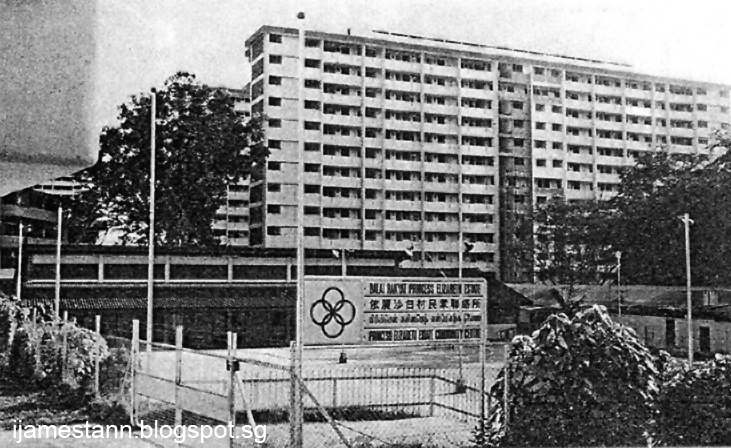
Princess Elizabeth Park Estate.
The artisan quarters (foreground) with the SIT flats built on the slope of Bukit Gombak (rear).


However, it was still viewed with envy by many for its then modern facilities. It had its own sewage treatment plant which meant all homes had toilets that flushed! This was remarkable then given that most public housing were still using the
'bucket system'. It had running water and electricity supply to every unit. The things which we take for granted today was but a luxury for many then. There was a direct bus service to the city.


They had a regulation-size football field, albeit, of the smallest allowed dimensions, that was the central meeting place for residents in the evenings to watch soccer matches that were held regularly by both the residents and the nearby factory teams. There was a primary school within the estate for the resident's children education.

A community centre was organised and ran by residents. This was long before the Singapore government built community centres of their own. The initial centre was a small shophouse at Clarence Walk but it later moved to a larger shophouse at Prince Charles Rise where it could organise kindergarten classes for children in the estate.


The P.E.E. Kindergarten at Prince Charles Rise, 1959.

In 1963, the government took over the management and building of all new community centres and a new community centre was built in 1963 for the residents. The community centre then came under the management of the People's Association with full time staff and resident volunteers to assist.


The new People's Association Community Centre at Princess Elizabeth Estate. 

Despite being built in the 1950s, Princess Elizabeth Estate suffered from the lack of a produce market. Hawker pitches were ad-hoc and illegal. It was not till 1967 when a proper market was built. It was an experimental market by the HDB to combine a dry provision and wet market in one location and housing the hawkers in individual stalls.

The Princess Elizabeth Estate market 1967.

In the late 1960s & 70s, Princess Elizabeth Estate gained fame and some notoriety. 
The estate was well-known as the birthplace of many local musicians and bands. These included the Pests Infested, The Blue Stars and The Jumping Jades. Musicians like Ramli Sarip (Sweet Charity) and Moliano (Lovehunter) would all have their start connected with Princess Elizabeth Estate. 
A dark side to the  estate was that in the 70s, it was a haven for drug abusers and was raided constantly by the Central Narcotics Bureau.


Private housing developments at Hillview
In the early 60s, the former gambier plantation land beside Princess Elizabeth Estate was bought by housing developers, Malaysia Land Investments Ltd and Singapore Trading Co Ltd, for the construction of terrace houses.
Singapore Trading Co. built about 300 units of single storey and two-storey units. They called the new development Popular Estate. 

Advertisement for the sale of homes at Popular Estate.

In creating Popular Estate, six new roads were constructed at Hillview.
These were Jalan Dermawan, Jalan Zamrud, Jalan Intan, Jalan Gumilang, Jalan Remaja and Jalan Batu Nilam. The first residents moved in around 1965.

Popular Estate, fronting Elizabeth Drive. picture taken 2019.
Most of the homes have been rebuilt and renovated over the years and hardly bears any resemblance to the original houses.


By 1968, the second private development called Bamboo Grove Park was ready for occupancy. Similar to the private landed properties of adjacent Popular Estate, Bamboo Grove Park comprised terraced, semi-detached and bungalow homes. New roads built to access the homes were Chu Lin Street and Chu Yen Street.

In the early days of their residency, owners of these houses were faced with many teething problems. From mud slides from the 'never-ending' house building, low water pressure to houses uphill, to a lack of bus services. Worse for early residents was the fact that it was located beside an industrial area. 

Air and noise pollution were the greatest gripes. Residents along Jalan Batu Nilam were breathing the constant fumes and pungent smell of cooking oil from Central Oil Refinery. Residents at Bamboo Grove were faced with the incessant pounding of metal from the adjacent metal works and the dust from the ceramics tile factories! The residents were even bombarded by flying granite shrapnels that flew into their houses on many occasions from the granite quarries at Bukit Gombak.

Landslide at Jalan Dermawan, 2007.

Over the years since, more houses were built beyond Popular Estate and Bamboo Grove Park, called Hillview Gardens Estate.  Today, it is generally accepted that the entire landed property area is colloquially called 'Hillview Estate'.

Jalan Remaja, separating Bamboo Grove Park from Popular Estate.

Another Hillview Estate?
In 1975, the Housing and Development Board (HDB) announced the building of a new 'Bukit Batok Estate' as an extension to Princess Elizabeth Estate. Ten slab-blocks of the standard HDB design and three point-blocks would be ready by 1978.
The new estate would be named Hillview Estate and would include a wet market, a hawker centre, 33 shophouses and 4 coffeeshop eating houses. It will also have a new community centre.

The new estate would be built north of Princess Elizabeth Estate on land occupied by a Chinese kampong, opposite the Castrol factory. The kampong folks were most unhappy over the acquisition of their homestead but were crushed to learn that they were squatting on state land all the while. However, the kampong folks were given compensation and relocated amicably.


The Chinese kampong being demolished to make way for the HDB Hillview Estate.


The HDB Hillview Estate in 1978.

The new People's Association Community Centre at Hillview.
It was later renamed Bukit Gombak Community Centre.
It would be the 4th iteration of a community centre at Hillview.

With the building of HDB Hillview Estate and the HDB new policy of home ownership, residents of Princess Elizabeth Estate were encouraged to buy a flat at the new estate. It was announced that no further development would be made at Princess Elizabeth Estate and empty flats would be mothballed to discourage rentals. The old Princess Elizabeth Estate Community Centre would be shut down. Princess Elizabeth Estate would face a slow run down until 1985, when all its residents who still remained were offered new flats at Bukit Gombak New Town.

Princess Elizabeth Estate School shifted to a brand new building at Bukit Batok New Town in 1986. The old school building was retained and converted into a facility for the disabled, the Red Cross Home for the Disabled. It was later sold to the United Medicare Centre and converted into a nursing home. Princess Elizabeth Estate, the gift to the royal couple, was finally demolished in 1985.

The old Princess Elizabeth Estate School 1955-1986.
Revived as the Red Cross Home for the Disabled. In 2010 became the United Medicare Centre nursing home.

The HDB Hillview Estate itself would come to grief in 1999 when it would come under the HDB Selective En Bloc Relocation Scheme (SERS). The entire estate was to be demolished and residents would be offered new flats at Bukit Batok Ave 5.

The demolition of Hillview HDB Estate under the SERS programme.

The Hillview field where once Princess Elizabeth Estate and Hillview HDB Estate were sited.
The row of trees in the middle marked the separation of the two estates.
The field has been left to fallow for the past two decades.
In 1979, at the southern end of Hillview Road, the HDB began the construction of the new Bukit Batok New Town. A portion of Hillview Avenue was renamed Bukit Batok East Ave 2, with Hillview Avenue shortened to end at this junction. Bukit Batok New Town eventually would house over 140,000 residents. The old Poh Kim Quarry at the end of Hillview Avenue would be converted into the Bukit Batok Nature Park along with the development of the New Town.


The coming of the Condos
With the re-designation of Hillview into a residential zone in 1994, companies located there started to shift their operations out, with most selling their land to housing developers.
But even before this had occurred, some companies, prior to the re-designation of 1994, had already decided to close their operations and had requested the authorities for a 'change of use' for their properties. Was this the impetus for SLA to redesignate the zone? One wonders.

Cycle and Carriage Co Ltd and Supreme Star Ltd had stopped production of their vehicle assembly plants around 1981 due to the government lifting of tariff protection on vehicle parts.
Cycle and Carriage was a major land owner at Hillview and had a lot of clout.
Their huge assembly factory plot was developed into private landed properties called Hillview Villas.  It was so large that new roads within had to be laid. These were Hillview Drive, Hillview Way and Hillview Crescent.

Hillview Villas, developed on land that was the former Mercedes Benz assembly factory.

Cycle and Carriage would continue land developments with the building of Meralodge, Montrosa and Merawoods condominiums. One of the early condo development at Hillview was Hillview Heights on the old Union Carbide factory site.

My blog article here will not cover the development of individual condominiums as I'll leave that to others who may be better specialists in the condominium history at Hillview.
Today, in 2019, there are more than 34 condominiums within the Hillview residential zone.
With the increasing condo developments, new roads within Hillview had to be created as a result.
The first being Hume Avenue, (so named as it was built over the old Hume Industries land, and not named after the founder of Hume as alleged in Wiki), Hillview Rise and Hillview Walk to prepare for future development.

The only commercial building to date is the HillV2, while the latest offering is The Midwood, expected to be completed by 2023.

The HillV2 development is the only one with commercial shops integrated.


The Lanai, just one of the many condos along Hillview Avenue.

Hillview Avenue in 2019.
Surprisingly, the same road that was used for the 1956 & 1957 Grand Prix.
Hillington Green on the left with Hillvista on the right.

The new Bukit Gombak Community Club built by People's Association in 2019.
This would be the 5th time a community centre would be built in Hillview.

Hillview MRT Station was built beside the old, now defunct, Standard Chartered Bank building.
It was opened in December 2015 and serves the residents of Hillview and Dairy Farm region.
A new station, Hume Station, to be located opposite the former Ford factory, is scheduled for 2023.

According to the 2019 Singapore Master Plan, there will be an 'Educational Facility' built at the junction of Hillview Avenue and Elizabeth Drive in future.

Extract of the 2019 Singapore Master Plan on the Hillview region.
Orange areas are residential plots, blue areas are commercial,
red are public community areas and the light yellow E is educational.


If you have read this article up to here, thank you very much for your patience and for visiting my blog.

While writing this article, I came across many interesting snippets of information regarding Hillview, some of which are in other posts here already. I didn't include these in order not to distract from the history. I'll try and gather them all and perhaps my next post will be on these snippets. AND finally, after eight long years, I will pen the follow up to the most asked question about the Hillview Haunted House - Why did it become haunted?

Links:
An anecdotal history of Hillview Part 1. 1840-1945.
An anecdotal history of Hillview Part 2. 1945-1955.