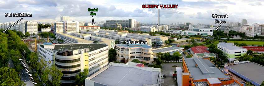
He had dwelt into and kept precise records of all 934 men from the 1st Battalion of the Leicestershire Regiment. He has continually updated the records of almost all these men, where they fought or died whilst in Singapore, Malaya, or the Thai POW work camps after the surrender to the Japanese forces.
He is particularly attached to the history of this regiment because his father, John Hewitt, was a soldier in this unit. His father's unit fought the invading Japanese soldiers from their landing in northern Malaya in December 1941, all the way down to Singapore. In Singapore, the unit was part of the 15th Indian Brigade that fought and lost the battle at Bukit Batok, before being captured as POWs when the British Army surrendered Singapore on 15 Feb 1942.
 |
| The retreat and ambush at Bukit Batok of the 15th Indian Brigade, 11 Feb 1942. Click on pic for detailed view. |
From Regimental records, it was known that 68 Leicestershire men were listed as "missing" after they were ambushed at Sleepy Valley in Bukit Batok. The bodies of these 68 men were never recovered and they are commemorated on the Singapore Memorial at Kranji War Cemetery. Mr Hewitt was trying to find more information on these lost 68.
Of the 68 records, 5 entries had a notation that they were buried by a Major Saggers in a common grave at a map location marked as 753147.

When Ken Hewitt googled "Singapore map reference 753147", he was surprised to find a map with that exact spot already marked off!
This was a map I had 'created' while doing a blog about the Australian soldiers who died at Sleepy Valley. I had done this map back in Jan. 2013 to help an Australian family find the location of their grandfather who died fighting at Bukit Batok and was buried in an unmarked grave somewhere in the battlefield. I had managed to find the grave location at Toh Tuck Road. ("Searching for an unmarked grave") link here
 |
| The location of the unmarked war grave that was to lead to the search for the POW camp. |
The search for a lost POW Camp
This coincidence led Ken Hewitt to contact me and we had several discussions by email on the battle and the events that took place here. In one of our chats, Ken had almost casually mentioned, more of an afterthought, about a POW camp where some Leicestershire soldiers were incarcerated for a while before being sent to Thailand. He said that since I did a lot of research about the Bukit Timah area, have I heard of a POW camp called McArthur Camp?
He was hoping that as a local 'man on the ground', I would be able to confirm the location of the POW camp. Apparently, the existence of this POW camp was known and vaguely appears in some records but its location was unknown, except that it was in Bukit Timah.
A Prisoner Of War camp in the Bukit Timah Hillview area? I was really intrigued by this!
I had not heard of this till then and pressed Ken for more information.
In brief, Ken gave me the following clues to whatever he knew of McArthur Camp:-
1. It was in the Bukit Timah area, south of the Ford Factory.
2. It was about 20-30 minutes march from the Ford Factory.
3. The Leicestershire POWs passed a cafe called Mendoza's, going to and from the camp.
4. It was in a hilly area.
5. Hillview Estate was mentioned as a possible site.
6. There was a WW2 International Red Cross reference to a "Bukit Timah POW Camp".
7. Lord Louis Mountbatten visited the camp after the war before the POWs had been repatriated and there was a newsreel in the Kew Gardens archive of this visit.
The first four clues came from Ken's informant, an ex-POW, Tom Sansome then 98 years of age, and still living today. Tom could vividly recollect his days as a POW here and remembered being forced marched each day from McArthur Camp to the Ford Factory or the adjacent Hume Pipes factory to do menial labour. More importantly, he recalled that the march took between 20-30 mins along Bukit Timah Road.
The other clues came from Ken's contact with a fellow WW2 researcher, Ms. J.B. Nielsen, who lives in Denmark. Ms. Nielsen had previously done a map of all 58 POW camps in Singapore for the Changi Museum. She had based her information of McArthur Camp on the grid reference coordinates of a 1945 Red Cross map. Apparently, she had also found my blog and referred to it with the possibilities that McArthur Camp might also be at Hillview Estate, or somewhere at Hindhede area below Bukit Timah hill.
So thus began for me, a project that took more than a year to accomplish.
The finding of McArthur POW Camp.
Ms Nielsen had already used the clues from ex-POW Tom Sansome, calculating the marching time against distance travelled and basing on the fact that the Red Cross had marked a location on their map. She figured that it would most likely be correct that the "Bukit Timah Camp" marked, would in all likelihood, be McArthur Camp. Ken sent me some photos, illustrations and maps that Ms Nielsen had collated in her own search.
 |
| ( I have not requested for permission to use her material as yet, so this is just a screenshot of what Ken Hewitt sent me with her permission.) Please note that copyright of this image belongs entirely to Ms. JB Nielson |
As Ken said, being the local man-on-the-ground, I immediately saw that it was Beauty World Town that was marked as the location of the POW camp. In fact, the map coordinates pointed exactly to a spot, just beside Jalan Seh Chuan, that was the old Tiong Hua Cinema. This revelation immediately raised doubts for me that this was not the location of McArthur Camp.

This was because I knew the history of Beauty World to an extent.
Beauty World Town was built during the Japanese Occupation. At what was Bukit Timah Village, Beauty World Town was constructed initially as an amusement park by Chinese businessmen in co-operation with the Japanese authorities! It was called the Great East World, in reference to the Japanese wartime strategy for the creation of the Greater East Asia Co-prosperity Sphere for the S.E.Asia region.
The Great East World, in similarity with the other amusement 'worlds' in Singapore - i.e. Great World, New World, Gay World and Happy World - had amusement game stalls, food hawkers, bars and cabarets, drinks and coffee shops, photo studios, clothing stores, etc. Tiong Hua Cinema played mainly Japanese movies and propaganda films. Gambling dens were not only permitted but encouraged as well.
Significantly, Beauty World Town had electric lights and electric power from generators. The whole place was lit up like a beacon in dark rural Bukit Timah, so much so that people started calling it Beauty World because of the lights and glitter, and this nickname has stuck till today.
So to me, the spot where Red Cross indicated as the POW camp could NOT be correct.
It just didn't make sense to build a POW camp in the same commercial vicinity.
To confirm my doubts, I asked a good friend, Mr L.Y. Mok, who is a professional cartographer and war expert. I sent him the grid reference, a picture of Mountbatten at the camp and told him a little of McArthur camp. I asked if he could verify the picture with the Red Cross reference. Mok had not come across a POW camp called McArthur in all his years of experience with mapping military locations. The nearest POW camps that both of us knew in the Bukit Timah region was either the ones at the old Turf Club or at Chua Chu Kang Road.
After some time perusing all the available data, Mr. Mok told me he was doubtful that the photo of Mountbatten was taken from the Beauty World area as the terrain and background didn't match what was found at the marked site.
Mr. Mok then sent me a map that was available at the National Archives which I had never seen before. It showed locations of military installations immediately after the war. On this map, there was a "Japanese Officers POW Camp" indicated beside the Gimson School at Clementi Road. Gimson School was the old Reformatory, a detention facility for wayward boys, at Reformatory Road. This map would come to play a crucial part in later research.
 |
| The post-war map that would lead to the finding of the POW camp, |
To confirm what Mok had deduced, I also reached out to another war history friend, Peter Stubbs. Peter is the owner writer of the blog fortsiloso.com. Peter had not heard of McArthur Camp but he had a reference to a 'Bukit Timah Camp'. It was from a wartime intelligence docket which listed the locations of all known POW camps in Singapore at that time.
The docket had the same grid reference as the Red Cross map - 760152+. But what was very significant in this intelligence docket, that was not available in the Red Cross map, was the '+' behind the number 760152.
This '+' indicated that the location was 'unknown' and the GRID numbers referred to the nearest town in that locality. So the numbers pointed to Bukit Timah Village, the nearest town, and not the camp itself.
 |
| The British Army intelligence docket list of POW Camps in Singapore. |
I had to break the bad news to Ken Hewitt, as well as to debunk another theory that they had.
This was that McArthur Camp could possibly be at Hillview Estate.
Hillview Estate was a rubber plantation as well as the name of a colonial house that was commandeered by Maj-Gen Gordon Bennett, the Commander for all Australian Forces in Singapore (the 8th Division, 2nd AIF). He used this house as his headquarters during the outbreak of war in Malaya up to the time the Japanese invaded Singapore. They had presumed it might be an army camp and could possibly be used as the POW camp after the capitulation.
Hillview Estate was located at De Souza Avenue and accessible only via Jurong Road (Jalan Jurong Kechil today). It was also only a 5 minutes march from the Ford Factory and was on top of a precipice facing Bukit Timah Road and so the POWs would have to climb up a cliff if the camp was indeed there. So the facts didn't match Tom's description.

So, I was back at Square One. McArthur Camp was not Hillview Estate and was not at Beauty World. So where could it possibly be located? Perhaps around Rifle Range or Hindhede kampongs?
Fortuitously, Ken had another meeting with Tom Sansome and brought some questions I had asked.
Did he pass a cemetery on the march? (can't recall). Was the road uphill? (I was thinking Clementi Road) - No, it was level most of the way, an easy march. Did he notice the railway line? (No)
Then, an important fact was revealed. At the end of the return march, they made a right turn at a road junction and the camp was just there after the right turn!
So, based on about 20-30 minutes march and a right turn to base, that would place the camp within the Rifle Range area at the furthest. The right turn meant only 3 roads can be considered - Jalan Jurong Kechil (Jurong Road), Reformatory Road and the road leading to Bukit Timah Railway Station. Marching south, these were only three roads where they could make a right turn, not considering country tracks as Tom mentioned roads not tracks.
The road to the Bukit Timah Railway Station was eliminated as Tom said they didn't see any railway lines. So that left Jurong Road and Reformatory Road (Clementi Road).
My initial gut feeling was that it was on Reformatory Road and that the POW camp would be the Reformatory building itself, though I had zero evidence for this!
Why build a new POW camp when the Reformatory was a ready-built detention centre, was my thought.
But the distance to the Reformatory would eliminate this option.
It would take at least an additional 20 mins march from the right turn junction to the Reformatory itself. And it was hilly with an undulating road where Tom had said it was levelled.
So it now looked like maybe back to Jurong Road? Could the camp be further up behind Beauty World, where Cheong Chin Nam had his pineapple and banana plantations?
But a right turn at Jurong Road would lead directly back into Beauty World, which I had already dismissed as a possibility. I couldn't find any confirmation so this point was left open till I could get more information.
Aerial Photomap Surveys.
In the 1950s, the RAF did aerial surveys of Singapore for mapping purposes. These old aerial maps can now be seen at the National Archives, as well as in other archives like the Imperial War Museum in London and the Australian War Memorial in Canberra, where they are in public domain. There are thousands and thousands of pictures and finding the correct one is like finding your pin in the haystack!
Over the next few months, I poured over any aerial maps of the area I could find, trying to seek anything that look remotely like a POW camp.
The earliest set of pictures I could find dated from 1953. Scrutinising these resulted in frustration and tired eyes, urghh. The aerials of Jurong, Bukit Timah Village and Reformatory Road yielded absolutely nothing that can be construed as military use.
(on the flipside, I managed to happily discover the battlefields of Sleepy Valley, small vindication)
 |
| Bukit Timah Village 1953 |
 |
| Reformatory Road (Clementi Road) 1953. Gimson School (The Reformatory) at top centre, King Albert Park at bottom left. |
Eureka!
Then three months ago, I came across a batch of aerial photos that dated from 1947. One was a picture of the area around Reformatory Road and it had features that were not on the 1953 photo above!
 |
| Bukit Timah Village, January 1947. |
This was my Eureka moment! There it was, clear as daylight. That's an army camp! That's a POW camp! I was delirious with the find.
(I will now show you what I saw but warning here, you can't unsee it thereafter, so look at this picture before moving on to the spoiler, ha ha).
 |
| This 1947 photo was taken in a South-North orientation, so North is actually at the bottom. Compare this close-up with the 1953 Reformatory Road photo above (look at the bottom left section) |
So there it was! It must be the Japanese Officers POW Camp as indicated in the Military Installation map sent to me by Mr Mok. The map had placed the Japanese Officers POW Camp north of Gimson School and this was the only installation on the photo north of Gimson School. After the war, all Japanese Army officers remaining in Singapore were interned at this camp before repatriation to Japan. But was it also McArthur Camp? ...
(To help you understand the above picture, the KTM Railway line is on the left edge, top to bottom, Bukit Timah Road runs across at bottom left with the overhead railway truss bridge. The two rectangular area at the bottom left would be where the Green Bus Depot would be built and the area above it is King Albert Park under construction. Reformatory Road (Clementi Road) runs top to bottom in the middle of the photo.
The Japanese Officers POW Camp is at the middle right. The Ngee Ann Teochew Cemetery is the open space at the bottom right below the POW camp.)
On close observation, you can see features that indicated what could have been once up to 17 structures or buildings on the site. But the photo taken in Jan 1947 show only about 7 to 8 buildings still intact. A possible reason is that the camp was being dismantled when the photo was taken.
Further digging produced another picture of the area. This was taken in March 1948, more than a year after the above Jan 1947 picture above.
 |
| The same area in March 1948, a year after the 1947 photo showed fewer buildings and grass had grown around the existing buildings. |
But the question still remained, was this Japanese Officers POW Camp the McArthur Camp we were searching for?
The evidence seem to point that way. It was within a 30 minutes march from the Ford factory. It was in a hilly area. It was just after a right turn off Bukit Timah Road.
I tried comparing a photo of Lord Mountbatten's visit in 1945 against one of Ngee Ann Polytechnic from the same angle. The background 'seems' to fit.
 |
| The hills in the far background appears to be Bt Batok on the left and Bt Timah on the right. The trees in the middle would be those within the camp compound. (Screen capture of War Office Directorate of Public Relations Newsreel No JFU318. Copyright of Imperial War Museum) |
 |
| Arrow show the probable angle from which the Mountbatten photo above was taken. |
Did I fail to mention that the site now is the location of Ngee Ann Polytechnic at Clementi Road?
The Clincher
Up to this point, I was 95% convinced that the Japanese officers POW camp was McArthur POW Camp.
All circumstantial evidence pointed to it but there was still the contention that there was no documented verification. That is, until...
This report in the Straits Times of 30 January 1947.
A Japanese Army officer, Major Tadakatsu Ishijima, had escaped from McArthur Camp on 15 December 1946! So, if all Japanese officers were confined to McArthur Camp, and the Japanese POW Camp was at Reformatory Road.???
So there! Confirmation that the Japanese Officers POW Camp was McArthur Camp.

In conclusion
and soldiers from the Indian Regiments.
After the surrender of the Japanese, it was used to intern Japanese Army officers.
It was demolished sometime between 1948 and 1953(?) when it no longer appeared on aerial photos.
It was located beside the Ngee Ann Teochew Cemetery at Reformatory (Clementi) Road, after the junction with Bukit Timah Road.
Today the Ngee Ann Polytechnic sits over the former POW camp site.
 |
| Close up of McArthur Camp, March 1948 |
This is not the end of the story...
Do return to my blog for updates as there are more unanswered questions.
Of the 58 known POW camps in Singapore, this was the only one that was named after a person. Why? The other 57 were all named after the location they were at.
Who was McArthur and why was the Camp named after him?
Which units were incarcerated at that camp, besides the Leicestershire men?
As for Major Tadakatsu, thank you for your daring escape and getting your crime being reported. You did me a big favour seven decades on.
Thanks for reading this long stuff if you have reached this point. I admire your endurance and threshold for pain!
Related links to this story:-
Searching for an unmarked war grave
The tragedy at Sleepy Valley
Of Udaya and the Mendoza Cafe
The colonial Hillview Estate
Roll of honour - Tom Sansome
UPDATE: 16 APRIL 2020
Today, I was informed by Ken Hewitt of the passing of Tom Sansome during the previous night.
Tom Sansome was instrumental in our search for the location of MacArthur Camp (or McArthur Camp). It was through his vivid recollection of the short time he spent there that enable us to finally determine the exact location of the POW camp. Tom had just celebrated his 100th birthday in September 2019 and maintained his mental faculties right to his end, succumbing only to his physical frailty. We thank Tom Sansome for all his past services. May he rest in peace.
Link to the Roll of Honour for Tom Sansome